Bowes and Bounds Connected
A Community Network for Bowes Park and Bounds Green
Palace Gates to Seven Sisters – The lost railway line of Bounds Green, 1878 – 1963
Replies to This Discussion
-
Permalink Reply by Richard Matz on
-
Picture: A regular stalwart of the line - ex-LNER Class N7/1 No. 69646 0-6-2T in BR livery c1960 – built in 1926 and finally scrapped in 1962.
At the bottom of the three Avenues (Northcott, Cornwall & Braemar) that lead off the Bounds Green Road, a quiet leafy pathway runs past the sheltered housing complex of Palace Gates into the junction of the two small parks of Avenue and Finsbury Gardens. The sheltered housing scheme takes its name from, and occupies the former site of, the terminus of a branch railway line that ran from Seven Sisters, and one that played a key part in the development of the Wood Green area.
The Great Eastern Railway obtained Parliamentary approval in 1866 for a branch line to run from its existing Enfield line at Seven Sisters to the new leisure complex at Alexandra Palace being constructed at the time. Plans to link this railway with the Great Northern Railway’s branch line from Highgate to Alexandra Palace were thwarted by the cost of overcoming the steep gradients involved, and then by the fire which gutted the first Palace 17 days after it opened in 1873. A less ambitious suburban line terminating at a new station just 100 yards from the GNR’s existing station of Wood Green (now Alexandra Palace) was finally completed by the GER in 1878, with two intermediate stations at Green Lanes and West Green before it joined the main line into Liverpool Street at Seven Sisters junction. Both intermediate stations had small goods yards dealing mainly with solid fuels.
The name ‘Palace Gates’ was misleading as day-trippers hoping to access Ally Pally’s leisure facilities through the Dorset Road exit faced a stiff ¾ mile walk uphill in Victorian garb before they even caught site of their destination. Services initially ran into Liverpool Street, but improved rail network links led to the introduction of a regular service to North Woolwich in 1887, and this remained the mainstay of the line right up until its closure in 1963. It enabled people from the fast developing working class estate of Noel Park to access the docks and heavy industry of the East End as well as the munitions works at Woolwich Arsenal via ferry services over the Thames. The cheap early morning workman’s fares offered by the GER further fuelled house building activity along the line, and the increasing train use and development in that area was reflected in changes to the station name (Green Lanes in 1878, Green Lanes & Noel Park in 1884, Noel Park & Wood Green in 1902 and simply Noel Park by the time of closure in 1963). At its peak in 1936, the amalgamated London & North Eastern Railway recorded 250,000 passengers using Noel Park station annually.
Although it was a terminus, Palace Gates was built as a through station. The line ran on to a locomotive depot with a turntable, water and coaling facilities, a goods yard and carriage sidings that covered some eight acres in total, stopping just short of the GNR’s Hertford North branch line before the Bounds Green Road bridge. The lack of strategic and integrated planning consequent to numerous competing railway companies pursuing their own commercial ends meant that the potential advantages of linking the two lines was not fully realised until the Second World War, and only then for purely utilitarian purposes.
The imposing red brick and gabled facade of Palace Gates station was obviously built to impress the hordes of tourists that unfortunately Alexandra Palace simply failed to attract. With the demolition of Nightingale Hall and the subsequent construction of the Avenues, the impressive vista of the main entrance and capacious booking hall was eventually hemmed in by suburban housing during the Edwardian period, reduced to opening onto a cramped pathway between Cornwall and Braemar Avenues. The previously mentioned footpath between Avenue and Finsbury Gardens ran under a subway beneath the line just before the beginning of the platforms, and the dip in the path is still evident today.
A more understated passenger and goods entrance to the other side of Palace Gates station was accessed via a forecourt on the corner of Dorset and Bridge Roads. On race days up until the advent of the Second World War, trains of horse boxes pulled by large exotic visiting engines would arrive with the grooms leading their steeds through a widened exit to walk up onto the roads leading down to the race track at Alexandra Park. At the north end of the station, the two 750ft platforms with 260ft of awnings apiece were linked by an imposing, fully enclosed and glazed footbridge. The two redbrick towers with goods lifts supporting this crossing were quaintly warmed by a fireplace at each end. This substantial structure was the unique and most distinctive feature of Palace Gates station. The Great Eastern Railway Society’s website has some good views of it here:
http://www.gersociety.org.uk/index.php/stations/palace-gates-branch
By the Edwardian period, the Palace Gates Line was at a peak with 41 arrivals from and 38 departures to Liverpool Street at half-hourly intervals (more frequent during rush hours) each day, an hourly service to and from North Woolwich plus off-peak goods traffic. Then, in 1920, the GER completely overhauled and intensified its suburban services from Liverpool Street, and also introduced a colour-coded system that differentiated first and second class coaches (yellow & blue banding) and had specifically coloured boards on the guard’s van to indicate the train’s destination. Palace Gates services were denoted by a fetching shade of pink. The lurid colour scheme that resulted was described as ‘jazzy’ in the common parlance of the day and led to the whole operation being nicknamed ‘The Jazz Service’.
Two coach push-pull sets known as ‘autocoaches’ were also introduced at this time which allowed small tank engines to be operated by the driver from a cab in the rear coach with no reversing or run-around of the engine required at the each end of the line. The fireman remained on the engine footplate shovelling coal. These engines ran a half-hourly shuttle to Seven Sisters off-peak, but alternated with the Liverpool Street services to give a 10 minute train frequency in and out of Palace Gates during the rush hours (all in addition to the North Woolwich services).
Modern residents in the area who currently complain of the noise of trains being shunted at Bounds Green’s HST depot would likely have been struck deaf by the clanking, whistling, hissing, industrial cacophony that this volume of steam haulage would have produced practically 18 hours a day every weekday. All further compounded, of course, by similar noise levels emanating from the equally intense suburban shuttles and mainline express services thundering through the adjacent former GNR track. This was definitely not a locality for those of a nervous disposition.
The regular direct through trains to Liverpool Street had almost ceased by 1939 leaving the autocoach shuttle service link with Seven Sisters (where fast City bound connections could be made) but the North Woolwich service continued with 14 trains each way on weekdays in 1938 plus a generous hourly service late morning to early evening on Sundays. However, the outbreak of the Second World War and its aftermath marked the beginning of the Palace Gates line’s terminal decline. Wartime destruction of the Royal group of docks, City offices and the industrial base of London’s East End by the Luftwaffe, and the evacuation of many remaining businesses curtailed the North Woolwich service to peak time only. The Seven Sisters shuttle was withdrawn in 1942 with its brief over-optimistic post-war reprise in 1948 eventually halted by fuel shortages in 1951.
Post-War industrial reconstruction in the Blitzed areas was slow and demand for the North Woolwich service was further undermined by changes in employment patterns that were no longer concentrated in inner London. The last remaining once-daily direct service to Liverpool Street was withdrawn in 1947. Expanding electric tram and later trolley bus services had already started taking passengers on local journeys from Wood Green to Tottenham, Finsbury Park and Alexandra Palace East during the Edwardian era in direct competition with the railway route. Most damaging of all for the branch was the 1932 opening of the Piccadilly Line extension through to Turnpike Lane, Wood Green and Bounds Green – competition which inevitably drew even more passengers away from West Green, Noel Park and Palace Gates stations respectively.
The post-war increase in car ownership during the 1950’s and 1960’s further sealed the fate of the Palace Gates line. By the 1962 there were merely 6 trains to North Woolwich and 9 in the opposite direction at peak times only. The dirty ramshackle infrastructure, low uneconomic passenger numbers and poor service on the line seemed to characterise everything that the Beeching Report was shortly to identify as wrong with the nation’s railway system. British Rail did not wait for the axeman’s report and announced closure. The last passenger service ran into Palace Gates on Saturday 5th January 1963 – a special excursion for railway enthusiasts who had retained a special affection for the branch as one of the last steam operated lines in British Rail’s Eastern Region. Ironically, this last train was pulled by a diesel engine which then returned to Stratford empty – a sad and rather ignominious end to an important piece of local history. Some freight operations continued until the end of 1964 by which time all the small goods yards along the line were closed. A large Charringtons coal depot continued on the old GER site at Palace Gates up until 1984 when the decline in the use of solid fuels finally led to its demise but its rail access was via the Hertford loop.
From Palace Gates, the line originally ran through Avenue Gardens and over Park Avenue on a bridge whose abutments are still visible today beside a pedestrian crossing. The continuing embankment between Park Avenue and Station Road has been overgrown with a beautiful and verdant hurst of trees with unfortunately limited access. The Line then went over Station Road on another bridge through what is now the Public Library and onto yet another bridge to clear what is now the High Road in Wood Green. The high-level Noel Park station was situated on an embankment site subsequently built on for car parking in the modern Wood Green shopping complex (just south-west of the junction of Pelham Road and Gladstone Avenue). An architectural echo of the line can be seen in the pedestrian thoroughfare over the High Road that now links the two halves of the shopping and cinema complex and this is located just south of where the railway originally crossed the same road. The following short article from the Tottenham Civic Society helpfully maps the entire route of the line:
http://www.tottenhamcivicsociety.org.uk/Palace%20Gates%20Railway%20Walk.pdf
All of the bridges mentioned above were demolished after closure during the redevelopment of Wood Green in the 1960’s and most of the related railway architecture has also disappeared. However, Peter Kessler has traced and photographed what remains on the following website:
Bibliography & Further Reading
Branch Lines to Enfield Town and Palace Gates by J. E. Connor (2004)
London’s Local Railways, 2nd Edition by Alan A. Jackson (1999)
North Woolwich to Palace Gates – A Photographic Journey by J. E. Connor (1997) – Recommended!
The Railways of Tottenham by G.H. Lake (1945)
The Journal of The Great Eastern Railway Society, issues 34, 35, 45 & 60 (available to members only)
Wood Green 1894 (Old Ordnance Survey Maps) - The Godfrey Edition by David Mander (1994)
Wood Green 1912 (Old Ordnance Survey Maps) - The Godfrey Edition by David Mander (1993)
© Richard Matz – quote me by all means just as long as you attribute me as well!
-
Permalink Reply by Renato B on
-
Thank you for posting a very interesting article. I went to the primary school at St Paul's in Bradley Road. One of my classroom windows overlooked the railway and I often watched the comings and goings on the line just before its complete closure.
-
Permalink Reply by Stephen Middleton on
-
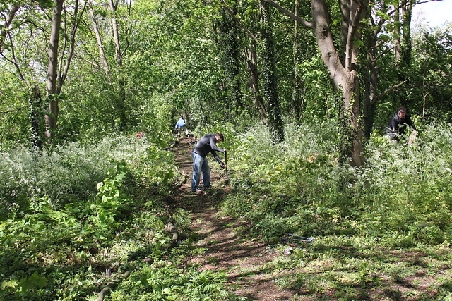
A picture from the section between Park Avenue and Station Road (unfortunately not open to the public) https://www.flickr.com/photos/47046427@N03/17659623918/in/album-721...
-
-
Fantastic. I grew up in Ringslade Rd. Thanks for posting the photograph. The embankment is well and truly matured.
-
-
This fantastic aerial view from 1930 shows a Liverpool Street train steaming out of Palace Gates and just about to cross the bridge over Park Avenue. The pre-WW2 incarnations of three pubs are visible. The Starting Gate is towards the bottom left-hand corner opposite the Wood Green (now Alexandra Palace) station complex. The Prince of Wales pub (centre-frame) is on the corner of a an uninterrupted Finsbury Road and Trinity Road which runs past the then Trinity Wesleyan Methodist Cathedral down to the Fishmongers Arms at the Junction with the High Road (far right, mid screen). Please forgive my unashamedly male sense of orientation!
Britain From Above: http://www.britainfromabove.org.uk/image/epw031496
A further image in the comments section of the above shows the line crossing Station Road and gives a view of Wood Green prior to the construction of the Piccadilly Line. You can freely download these images to examine in more detail, but not for commercial use, and there are other views of the surrounding area onsite.
-
-
This is a fantastic photo. Thank you for posting. Has brought back childhood memories of my train spotting days at the Palace Gates station.
-
-
I thought this photograph (mentioned above) from c1930 merited a post all of its own. On the left, the Palace Gates line crosses Station Road. This in turn leads down to the junction with the High Road and Lordship Lane which is dominated by the landmark dome of Wood Green Public Library. Gifted by The Andrew Carnegie Foundation and opening in 1907, the Library and the adjacent parade of shops are now occupied by Haringey Council’s River Park House office complex. On the corner of River Park Road and Station Road, there seems to be a large faux-Tudor building that I can find no reference to anywhere. The tram sheds look far more extensive than the modern bus depot, and what is now left of River Park Road seems but a shadow of its former self.
Opposite the Library, The Nags Head Inn (now The Goose) faces Spouter’s Corner (now covered by the cinema complex). The later Underground station is conspicuous by its absence. The public Gladstone Gardens lines the west side of the High Road in the lower half of the picture, and these back onto the private grounds of The Elms – a detached Victorian pile with outhouses all later developed under the Broadway Parade.
Following the trams back north along the High Road just past the tram depot, The Three Jolly Butchers Hotel sat on the corner of Watson’s Road. This former coaching inn dating from 1781 was given a gaudy late Victorian makeover, the lush carpets, cut glass mirrors, lanterns, cupola’s and alcohol all offering a refuge from the often poor accommodation & harsh employment of the time. The incline leading up to the Bounds Green Road took its name from the pub – Jolly Butchers Hill. The site is now occupied by the Monaghan's Tavern pub on the corner of an uninspiring office block.
North of Watsons Road, the Printers’ Almshouses are visible with the Bounds Green Road curving round to the left. This site is now occupied by BT’s monolithic Greenriding House switching centre. St Michael’s Church is just out of shot to the right. Ground views and a more detailed history of most of the area pictured can be found in Albert Pinching's excellent “Wood Green Through Time” that also covers Bowes Park and Bounds Green in more depth. Explore and enjoy!
Britain From Above, comments section of: http://www.britainfromabove.org.uk/image/epw031496
-
-
Thank you for the comprehensive description of this photograph. I can see the entrance of the REX (formerly Palais De Luxe) cinema in Station Road with the auditorium in River Park Rd. A cinema I remember visiting as a kid. There was a factory at the top of Ringslade Rd/Watson Rd. I don't know what was made there.
-
-
Thanks Renato - I found this link describing the Rex Cinema in Station Road
http://cinematreasures.org/theaters/17331
The factory you mention is shown on the 1912 OS Map which describes it as the Northampton Works (Engineering), but is not in existence on the 1894 OS Map.
Both maps are listed in the bibliography above and can be purchased quite cheaply from The Big Green Bookshop in Wood Green. As they both cover exactly the same area, a comparison quickly reveals the shift in population gravity towards Noel Park away from the established Victorian centres of commerce and light industry around Myddleton, Commerce and Finsbury Roads.
-
-
Thank you for the link to a photograph showing the entrance to the Rex cinema. The entrance is just as I remember it. I have Bing'd and Googled the Northampton works and I see it was a "Printers' and type founders' engineers and machinists, printers' furnishers". This would explain the adjacent premises of the Printers' Almshouses. I remember the works and the almshouses were still occupied in the 50's.
-
-
This later aerial offering dating from 1938 starts at the bottom with Charles Holden’s Turnpike Lane Underground station by the old Ritz cinema opposite Ducketts Common (with the Wellington pub in its rightful place right on the junction), and follows the trams up Wood Green High Road towards Jolly Butchers Hill and St Michael’s church on the corner of Bounds Green Road.
From right centre, the Palace Gates railway line wanders over the High Road at Noel Park station towards its final destination. Gladstone Gardens and The Elms shown in the previous aerial image have now been built over by the Broadway Parade and the Gaumont Palace Cinema (subsequently: The Gaumont Theatre / Odeon Cinema / Mecca Bingo / The Dominion Centre). There’s more about The Gaumont on here:
http://www.arthurlloyd.co.uk/GaumontPalaceWoodGreen.htm
Barratts sweet factory complex dominates the upper left of the photograph just south of Wood Green Common. I found this thread on Haringey Online that includes a series of Youtube clips giving the history of Barratts and its modern incarnation as The Chocolate Factory centre for arts and crafts
http://www.harringayonline.com/forum/topics/a-history-of-barratts-sweet-factory-in-wood-green
-
-
1960's STEAM RIDE: NORTH WOOLWICH to PALACE GATES
This has only recently surfaced on You Tube and I’ve never seen this footage before
https://www.youtube.com/watch?v=27259L4WT-o
1961 GREAT NORTHERN MAIN LINE STEAM
On the adjacent line and from the same recent source, footage of large express trains thundering through local stations in Haringey from Kings X towards the Welwyn Viaduct
https://www.youtube.com/watch?v=86PMOU8vb_A
I’m five years old again!
Connecting the communities of Bowes Park and Bounds Green in north London.
Featured Content
Top Content
Translate this website
© 2026 Created by Richard McKeever.
Powered by
![]()